
-
Outdoor and Hiking Navigation
Latest Version: Publish Date: Developer: 3.68 2021-04-05 Onyx Technologie OG
ape@map 3D Outdoor-Navigation for hiking-maps, offline capable.
The description of Outdoor and Hiking Navigation
GPS navigation with more than 70,000 tours and help call (with SMS), PC planning software for maps of leading card manufacturers and interfaces to DVDs:
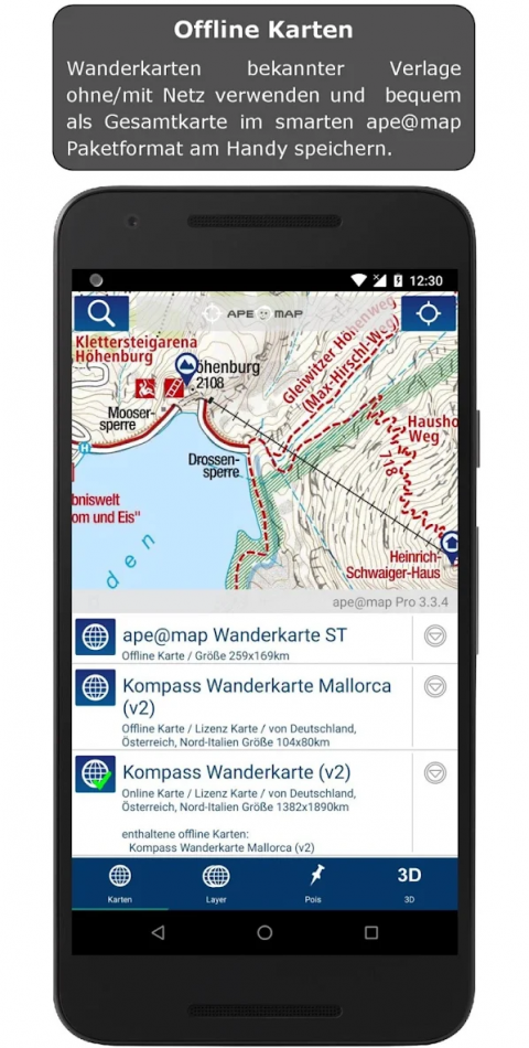
- Compass Maps (Switzerland, Austria, Canary Islands, Balearic Islands, Bavaria, Lake Garda, South Tyrol, ...), AMAP Austria,
- TOP 50 Germany,
- SwissMap,
- DAV & PES
- TouratechQV (Worldwide)
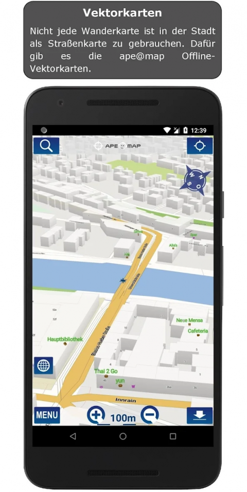
- Free OSM - Maps.
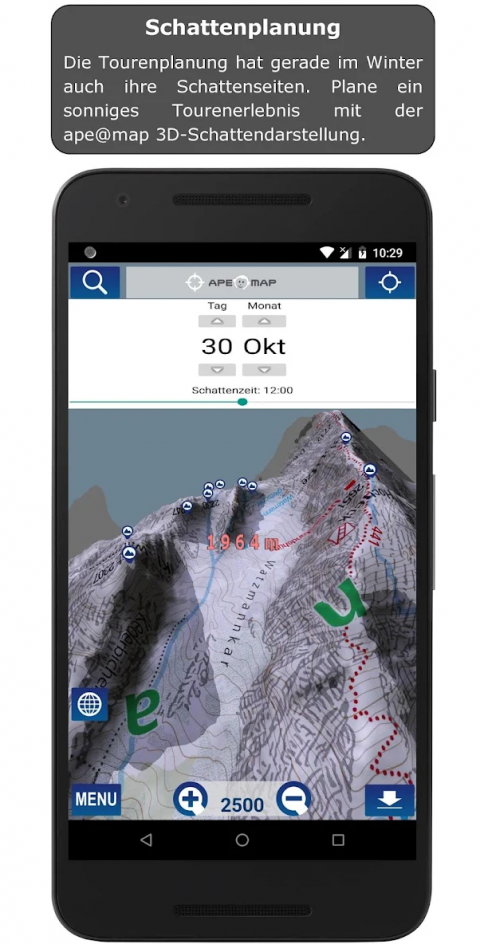
- First and real SRTM 3D display alongside Google Earth on Android.
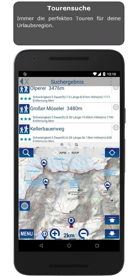
More than 70,000 tours (biking, hiking, skiing) from our partners gps tour.info, alpintouren.at and geo-coaching.net with reviews / height model / text / images COMPASS TOP50 maps and cards. The map coverage of the tour services currently affects South Tyrol, Austria and Germany and is constantly expanding.
ape@map works even without mobile network.
With the ape@map PC Viewer (ape@map desktop) you can plan routes on a PC or even offline maps and tracks (available for free at www.apemap.com) exported from PC to mobile phone.
(Info: NMS and SMS permission is required ONLY for sending and receiving location based requests for help or assistance)
Please contact [email protected] for further questions or error reports.
Only then will we have a chance to help.
- Compass Maps (Switzerland, Austria, Canary Islands, Balearic Islands, Bavaria, Lake Garda, South Tyrol, ...), AMAP Austria,
- TOP 50 Germany,
- SwissMap,
- DAV & PES
- TouratechQV (Worldwide)
- Free OSM - Maps.
- First and real SRTM 3D display alongside Google Earth on Android.
More than 70,000 tours (biking, hiking, skiing) from our partners gps tour.info, alpintouren.at and geo-coaching.net with reviews / height model / text / images COMPASS TOP50 maps and cards. The map coverage of the tour services currently affects South Tyrol, Austria and Germany and is constantly expanding.
ape@map works even without mobile network.
With the ape@map PC Viewer (ape@map desktop) you can plan routes on a PC or even offline maps and tracks (available for free at www.apemap.com) exported from PC to mobile phone.
(Info: NMS and SMS permission is required ONLY for sending and receiving location based requests for help or assistance)
Please contact [email protected] for further questions or error reports.
Only then will we have a chance to help.
What's new of Outdoor and Hiking Navigation
- Changes for Android 11 (file system, remove background location for track recording)
- Small UI adjustments
- Small UI adjustments
| Category: | Requirements: |
|---|---|
| Travel & Local | Android 4.4+ |
Related Apps for Outdoor and Hiking Navigation android
-

-
Buttons and Scissors
2021-10-22
-

-
Outdoor and Hiking Navigation
2021-04-05


