
-
NavShip
Latest Version: Publish Date: Developer: 1.31.1 2021-02-19 CproSoft
Free boat navigation assistance, supporting Europe, Canada and the US
The description of NavShip
Best for inland waterway routing! Please note, that some rivers and seas might not be included yet. Please use the contact form inside the app menu (report error at the bottom) to request a new waterway, and we will implement them as soon as possible.
Free version: Up to 40 km (25 miles) route planning and 8 km tracking. We use advertisement in free version.
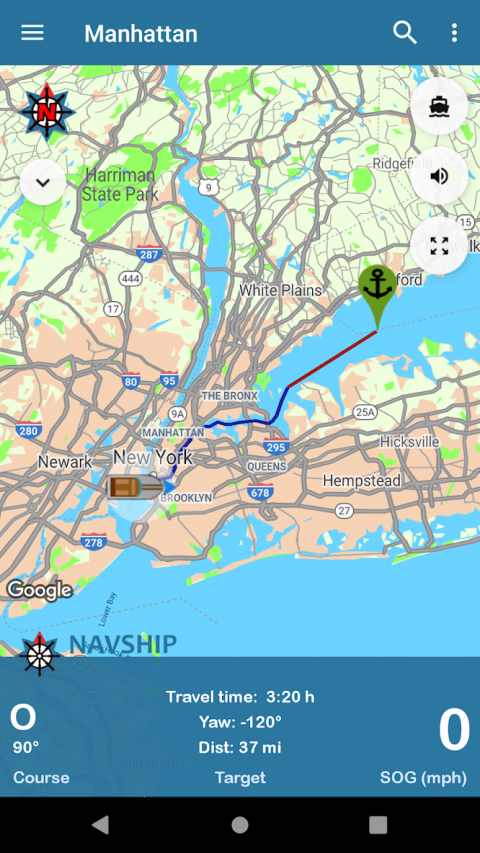
NavShip is a free navigation assistance software for nautic usage in Europe, Canada and the United States. It uses an special overlay for google maps or open sea map to show shipping signs and contains by now more than 250.000 waterways.
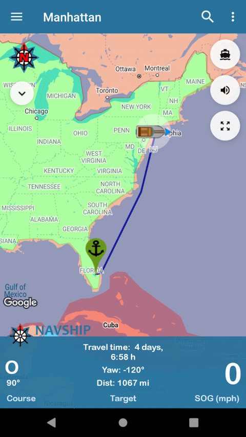
No problem to get from A to B, even if there's an ocean between you and your target. London - Rome, Paris - Amsterdam, Copenhagen - Stockholm, Frankfurt - Istanbul, Chicago - Toronto, nearly every route can be calculated.
NavShip needs access to device's storage to work properly. It never accesses your private data or contacts.
WEAR OS: NavShip provides a Wear OS App for Smartwatches. You can easily connect with live routing on your app. Calculate a route on your smartphone and view your current speed, course offset, distance and travel time via smartwatch. Even the next bridge or lock will be displayed.
Features:
Offline-Routing
Live-Routing
Kilometres or miles, km/h or knots
Travel time and distance
Approx. arrival time
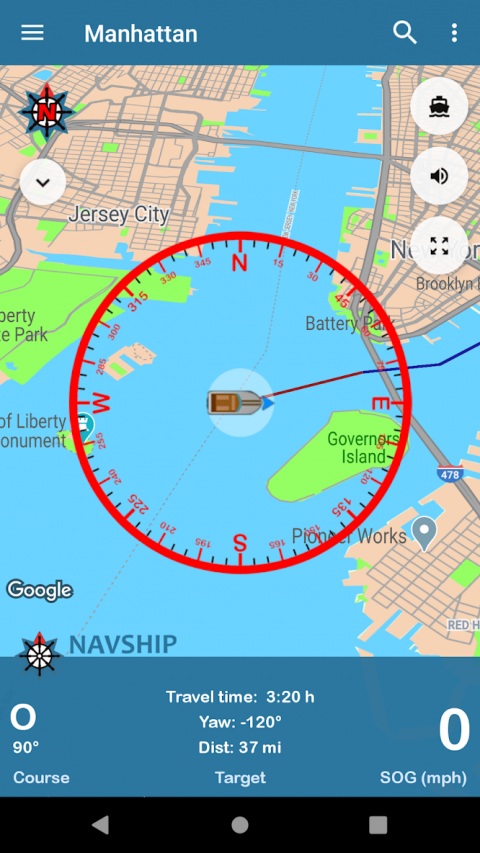
Course and speed over ground
Locks
Fuel and costs
Anchor alert
Implementation of own boat icon for routing
Lots of more...
Get more information at www.navship.org
Disclaimer: This app should only be used as an assistant. Please use it carefully and supportive. NavShip is not responsible for accidents. Please note the in app disclaimer and the terms of use at navship.org.
Free version: Up to 40 km (25 miles) route planning and 8 km tracking. We use advertisement in free version.
NavShip is a free navigation assistance software for nautic usage in Europe, Canada and the United States. It uses an special overlay for google maps or open sea map to show shipping signs and contains by now more than 250.000 waterways.
No problem to get from A to B, even if there's an ocean between you and your target. London - Rome, Paris - Amsterdam, Copenhagen - Stockholm, Frankfurt - Istanbul, Chicago - Toronto, nearly every route can be calculated.
NavShip needs access to device's storage to work properly. It never accesses your private data or contacts.
WEAR OS: NavShip provides a Wear OS App for Smartwatches. You can easily connect with live routing on your app. Calculate a route on your smartphone and view your current speed, course offset, distance and travel time via smartwatch. Even the next bridge or lock will be displayed.
Features:
Offline-Routing
Live-Routing
Kilometres or miles, km/h or knots
Travel time and distance
Approx. arrival time
Course and speed over ground
Locks
Fuel and costs
Anchor alert
Implementation of own boat icon for routing
Lots of more...
Get more information at www.navship.org
Disclaimer: This app should only be used as an assistant. Please use it carefully and supportive. NavShip is not responsible for accidents. Please note the in app disclaimer and the terms of use at navship.org.
What's new of NavShip
Added side menu entry for privacy policy
New menu entry to swap start and finish
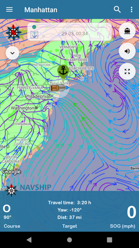
Currents in bodies of water are taken into account if it has been activated in the app settings (currently only for Rhine, Main, Neckar, Mosel, Waal, Lek, IJssel, Maas, Odra, Weser, Elbe, Lahn, Danube and Ems)
The app warns when the current of a river is greater than the maximum speed of the boat
Added new compass image
Updated translations
New menu entry to swap start and finish
Currents in bodies of water are taken into account if it has been activated in the app settings (currently only for Rhine, Main, Neckar, Mosel, Waal, Lek, IJssel, Maas, Odra, Weser, Elbe, Lahn, Danube and Ems)
The app warns when the current of a river is greater than the maximum speed of the boat
Added new compass image
Updated translations
| Category: | Requirements: |
|---|---|
| Maps & Navigation | Android 4.1+ |
Related Apps for NavShip android
-

-
NavShip
2021-02-19


